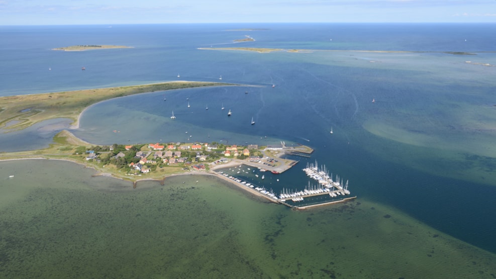
Langør Marina
Located in the preserved Stauns Fjord and is Samsø´s smallest. You find a restaurant at the harbour. Langøre is a natural harbour that has been used since the Viking Era.
Kattegat, Stavns Fjord, Samsø E-kyst
55°54,6’N 10°38,5’E – Map 112
The port is only navigable by day.
Largest ships there can enter the harbor: Length 40 m and depth 3.0 m.
The difference between the mean high tide and low tide is 0.6 m.
Wind between W and N can provide up to 1.0 m high tide and winds between SW and SE up to 1.0 m low tide.
The tide from Stavns Fjord passes the trench perpendicular past the harbour entrance about 50 m E of the harbour between the red and green buoy.
In Stavns Fjord Wildlife Sanctuary (Agriculture Ministry Order of 31 August 1987), it is forbidden to sail with motor vessel with speeds above 5 knots (except 10 knots in the marked fairway from Kattegat to Langør Harbour).
North of a line from the tip of Lilleøre to the tip of Langøre by the green buoy there is an excellent anchorage.
Heavy anchor gear is to be anticipated with winds exceeding 10 m / s, since the bottom is very soft.
Electricity and water at all bridges. Provisioning can be obtained (1 / 5-15 / 9).
Diesel and petrol cans.
Bedding for smaller vessels.
Repairs and diving can be obtained.
A 300-kg mast crane.
Bus during the school holidays.
Reusable containers.
Campsite 3 kilometers.